Start your hiking holiday in Chamonix with a panoramic view of the valley and neighbouring mountains. Below are some of the more popular hikes and walks in Chamonix Mont-Blanc.
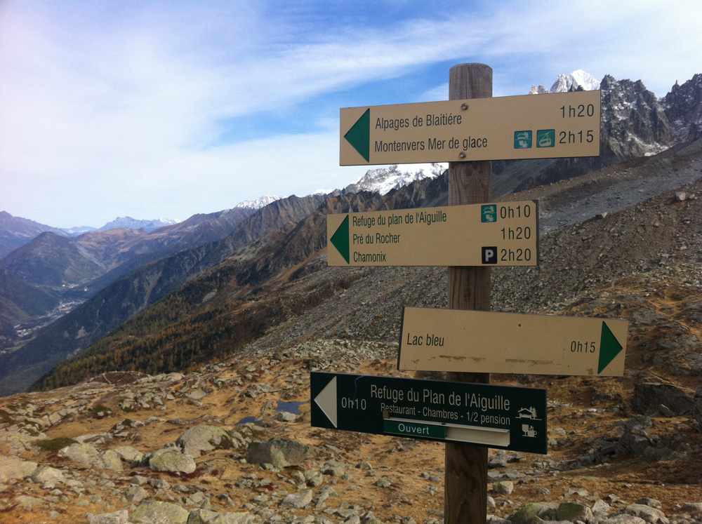
1. Plan de l'Aiguille - Montenvers Train Mer de Glace
Take the Aiguille du Midi cable car to an altitude of 3842m (12,680ft) and take in the breathtaking scenery. Descend by cable car back to the mid-station at the Plan d'Aiguille and then walk the steep, zig-zag, wooded track back down to Chamonix (3hrs) or cross over from the Plan d'Aiguille to the Montenvers train/Mer de Glace station (3 hrs) to take the tourist train back down to Chamonix.
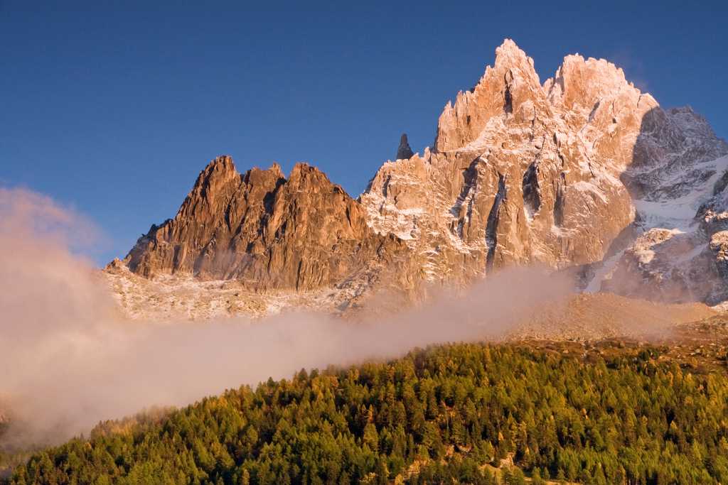
2. Aiguilles Rouges Nature Reserve Hiking - The Lakes
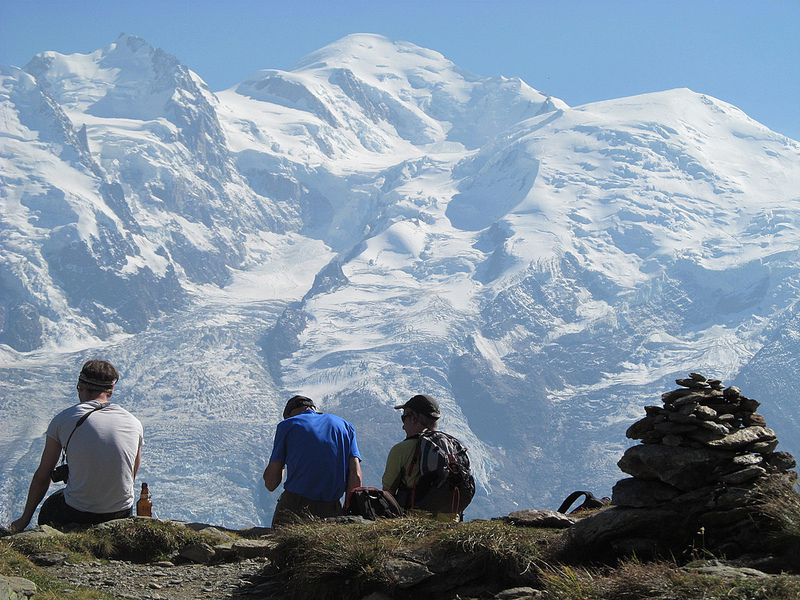
One of the best places to admire the Mont Blanc massif is from the other side of the Chamonix Valley. The Aiguille Rouge nature reserve is not to be missed!
- Lac Blanc (2352m) - A great place to enjoy the view of the Mont Blanc. From the Flegere / Index lift, the hike is a bit under 2 hours. You will find facilities and refreshments at the lake (Lac Blanc hut). A great place to have a picnic! IGN 3530ET
- Lac Cornu (2276m) - Take the Brevent lift up and follow the signs toward the Cornu. Pass under the Aiguille de Charlonon and up and over the Col Cornu (2414m). From the Planpraz lift to the lake is about 1h45. IGN 3630OT
- Lac Noir (2540m) - From the Col Cornu, head right on the marked path towards the Col de Gliere (2461m). This hike is less frequented as the path is slightly more challenging (2h30 from Planpraz) but it makes for a mystic picnic spot as the lake is often partially covered by snow and ice. IGN 3630OT
3. "Glacier Views" Hikes and Treks
One of the best ways to see a glacier up close is the above mentioned Mer de Glace. Another great way to see the Mer de Glace with fewer crowds is to head up to the Chapeau (1576m) from Lavancher. The hike is under an hour and has a couple great options for refreshments before and after the hike.
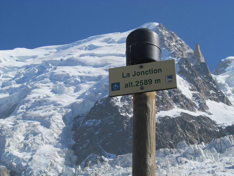
Another great glacier view hike is the Jonction between the Bossons glacier and the Taconnaz glacier. The Chalet du Glacier des Bossons (1425 m) is situated right next to the Bossons glacier and has food, drinks and amazing views of seracs. Hikers can start from the hamlet of Le Mont (40min) or the valley floor. This is a great hike because you truly are at the base of this amazing glacier, and the trail eventually continues up to the junction of the glaciers at 2600m.
4. Aiguillette des Posettes at 2201m (7,220ft)
Go to the Nature Reserve Exhibition at the Col des Montets. Then walk up above Le Tour to the top and a beautiful 360° view over France and Switzerland. (4 hrs total).
5. Berard Valley & Mont Le Buet Easy Hikes
The Vallon de Berard is a beautiful place to walk with the whole family. This is a gentle hike following the river up the valley and passing a waterfall right at the start. The hike is 1h45 to the Refuge Pierre a Berard. Trail heads can be found in the village of Le Buet. Park at the train station and walk across the street. This is part of the Aiguille Rouge reserve and it is not rare to see ibex, chamois and marmots. No dogs allowed.
If you are looking for a more challenging hike, continue on after the refuge up to Le Buet (3096m). From the refuge, take the trail heading right up the hill. The hike continues on for about 3h45 after the refuge. The views from the top are spectacular. Take lots of water, food, and sunscreen!
6. Buvettes en Montagne and Small Walks
Leaving the Chamonix Valley without visiting one of the magnificent Buvettes en Montagnes would be a pity. The Buvettes are sumptuous places that serve drinks and snacks. Their visitors enjoy a magnificent view of the mountains. To access one of these Buvettes, you need to walk a little.
7. Les Houches hikes and walks
Les Houches has a wealth of great hikes. One of the most popular is the Aiguilette des Houches (2285m). Start in the direction towards Bel Lachat passing the Lapaz river and the Carlaveyron prairies. The climb takes 3h15. This is one of the best panoramas of the Mont Blanc chain.
To make it a loop, head down towards the Chailloux chalets. This is an intermediate hike with some steep trails. To find the trail head, head in the direction of the Parc de Merlet in Les Houches and park just before the end of the road. Map - IGN 3531ET.
For any help or advice, contact one of the International Mountain Leaders. They offer a wide range of trips, and they know everything about trails, fauna & flora in the Alps.
Useful things to know when going on a Chamonix Valley walk or hike
There are plenty of hikes in the Aiguilles Rouges side of the Chamonix Valley including the GR5 whichpasses on part of the Tour of Mont Blanc route - TMB on some signposts. You can go up to the top station of Brevent by either walking up from the valley (3.5 hrs) or hiking across from the Flegere mid station (2hrs).
From the top of Brévent, hike along the ridge, past the refuge of Bel Lachat, down through woods to the Merlet Animal Park (see chamois, big-horn sheep, and ibex) and then back to the ever-visible town of Chamonix by the "Petit Balcon Sud" (3 hr).
If you need any help or any advice, you can contact any of the International Mountain Leaders. They can show you all the trails, the fauna & flora of the Alps.
Don't Forget: Use sunglasses and skin and lip protection. At these altitudes (up to 3000m, 10,000ft) it is easy to get badly sunburnt. Don't forget that a lift gains lots of height quickly and it can be cold and windy up there.
The weather can change quickly so check our weather forecast report before leaving.
The Tourist Office has a good supply of trail maps or buy "Chamonix, the most beautiful hikes for everyone" at newsagents. The Office de Haute Montagne (OHM) is another good source for information.