Chamonix Town Maps, Les Houches Town and Argentiere Village Map


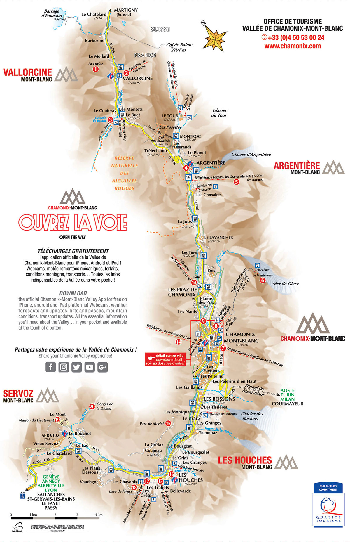
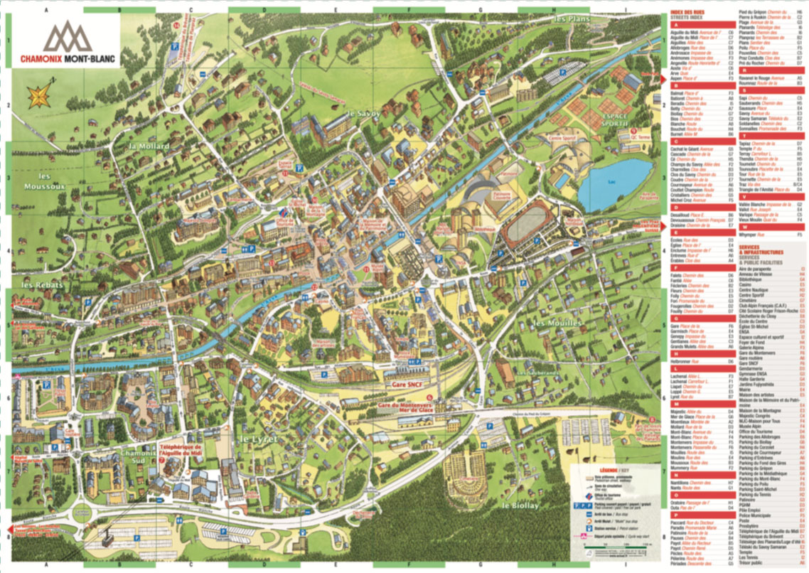
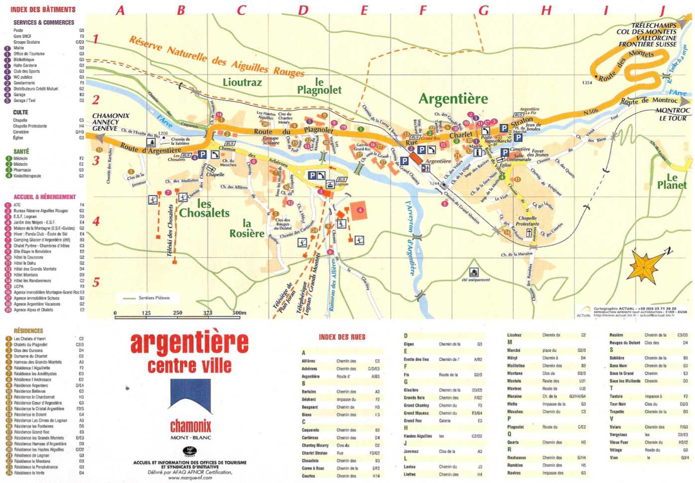
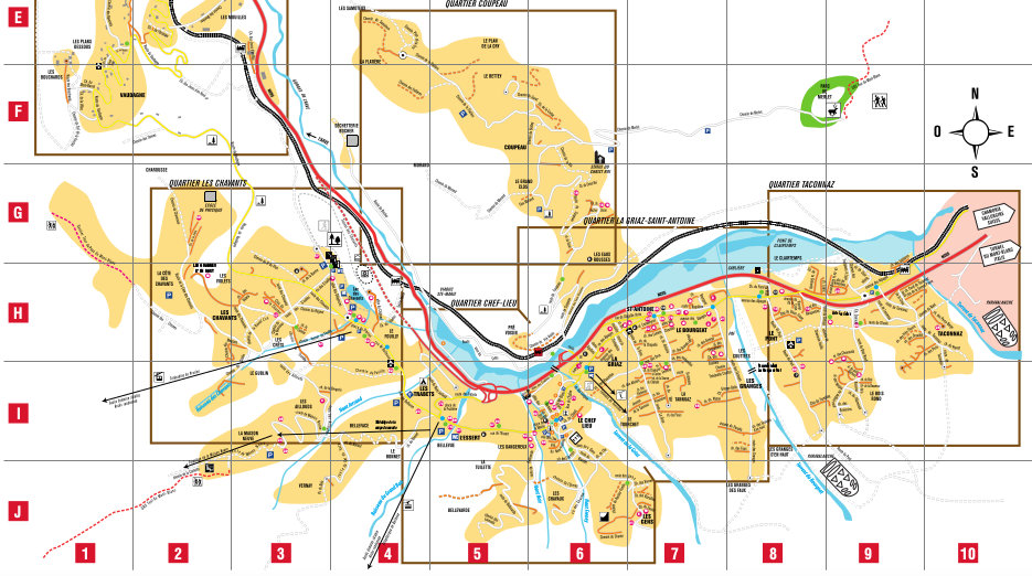
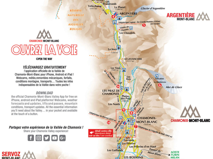
Download here the Maps of Chamonix town, Les Houches town and Argentiere village map in pdf.

Chamonix Valley map - version 2019
new map of chamonix town 2019
Maps of Chamonix Valley 3D
Maps of Argentière village town
Map of Les Houches village town

You can buy a folded, physical map of Chamonix that covers the entire northeastern half of the Mont Blanc Massif down to the Chamonix-Courmayeur tunnel by following this link.

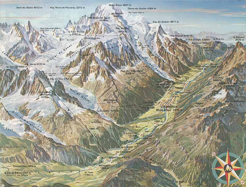
Great representation of Chamonix, easily recognizable mountain features, crevasses, moraines and rockfall zones. For the southwestern half (St-Gervais - Les Bains - Massif du Mont Blanc) there is another great map. Check it out by following this link.

Download high resolution versions of Chamonix Valley town maps in pdf, here:

Try now the FATMAP of Chamonix!

FATMAP: explore now Chamonix and its ski resorts in 3D

The map shows you the best runs, the sunniest areas, the top-rated restaurants, the viewpoints as well as lift status and weather conditions.

If you are using a mobile phone, download the FATMAP iOS or Android mobile app
If you are using the computer, from users experience better use Chrome to open the FATMAP

Check here the FATMAP of Chamonix