Snowshoeing Maps, Trails and Routes from Chamonix Valley


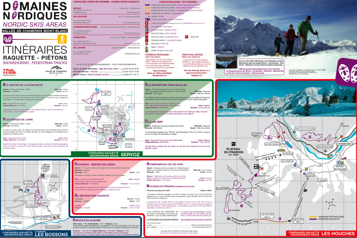
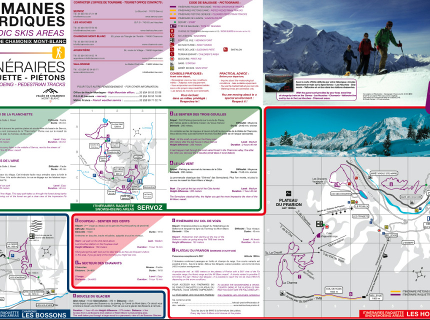
Here you can download the snowshoeing and winter walks maps for Chamonix, Vallorcine, Le Tour, Balme, Les Houches & Argentière.

Snowshoeing map for Chamonix Valley

One of the best printed guides to showshoeing walks is also available for purchase, if you would like a more detailed look into snowshoeing.

Try now the FATMAP of Chamonix!

FATMAP: explore now the Chamonix valley and its ski resorts in 3D

FATMAP - the most detailed ski map ever made!

The map allows to explore the valley of Chamonix Mont-Blanc in 3D ultra-high resolution with full freeride routes mapped and detailed. Classic and established off-piste lines are all marked with information about the route, steepness, length and difficulty.

Plan your day out on the slopes of Chamonix using FATMAP! The map shows you the best runs, the sunniest areas, the top-rated restaurants, the viewpoints as well as lift status and weather conditions.

Whether it's a classic hike or a new ski line, using FATMAP, you can access quickly all the key terrain and safety information you need regarding avalanche risk, crevasse zones and slope gradients, so skiers can make better-informed decisions and travel more safely.

Plan now your hiking adventure on both mobile and web:

If you are using a mobile phone, download the FATMAP iOS or Android mobile app
If you are using the computer, from users experience better use Chrome to open the FATMAP

Check here the FATMAP website!